


Mont Aigoual

Linerou
User
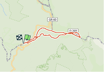

Length
7.3 km

Max alt
1561 m

Uphill gradient
221 m
Km-Effort
10.2 km

Min alt
1412 m

Downhill gradient
220 m
Boucle
Yes
Creation date :
2025-06-05 07:50:17.442
Updated on :
2025-06-05 15:10:36.408
2h07
Difficulty : Medium

FREE GPS app for hiking
 SityTrail
IGN / Geographical institutes
SityTrail Plus
The world is yours!
About
Trail Walking of 7.3 km to be discovered at Occitania, Lozère, Meyrueis. This trail is proposed by Linerou.
Positioning
Country:
France
Region :
Occitania
Department/Province :
Lozère
Municipality :
Meyrueis
Location:
Unknown
Start:(Dec)
Start:(UTM)
544265 ; 4884989 (31T) N.
Comments