


Ortiac- Abbayie St Orens

ollivier.albert
User
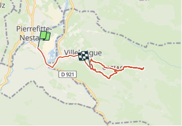

Length
6.7 km

Max alt
886 m

Uphill gradient
385 m
Km-Effort
11.4 km

Min alt
475 m

Downhill gradient
275 m
Boucle
No
Creation date :
2025-04-21 11:23:33.452
Updated on :
2025-06-05 15:52:45.584
1h47
Difficulty : Medium

FREE GPS app for hiking
 SityTrail
IGN / Geographical institutes
SityTrail Plus
The world is yours!
About
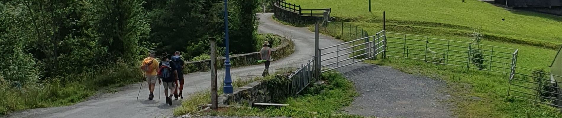
Trail Walking of 6.7 km to be discovered at Occitania, Hautespyrenees, Soulom. This trail is proposed by ollivier.albert.
Description
tres belle randonnée pyrénéennes avec notre guide mattéo
Photos


Positioning
Country:
France
Region :
Occitania
Department/Province :
Hautespyrenees
Municipality :
Soulom
Location:
Unknown
Start:(Dec)
Start:(UTM)
738797 ; 4760066 (30T) N.
Comments