


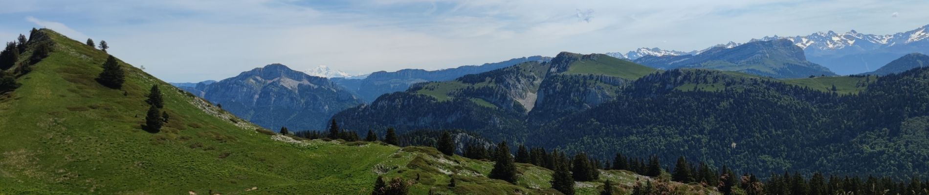
Boucle vers Hurtière depuis le col de la Charmette - 31 mai 2025

morganee
User
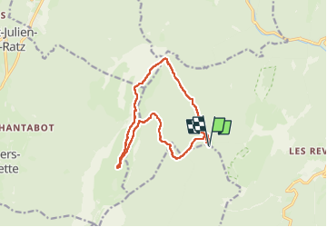

Length
13.3 km

Max alt
1750 m

Uphill gradient
630 m
Km-Effort
22 km

Min alt
1276 m

Downhill gradient
631 m
Boucle
Yes
Creation date :
2025-05-31 06:42:12.256
Updated on :
2025-06-06 17:09:53.418
5h45
Difficulty : Medium

FREE GPS app for hiking
 SityTrail
IGN / Geographical institutes
SityTrail Plus
The world is yours!
About
Trail Walking of 13.3 km to be discovered at Auvergne-Rhône-Alpes, Isère, Proveysieux. This trail is proposed by morganee.
Photos


Positioning
Country:
France
Region :
Auvergne-Rhône-Alpes
Department/Province :
Isère
Municipality :
Proveysieux
Location:
Unknown
Start:(Dec)
Start:(UTM)
714758 ; 5022332 (31T) N.
Comments