


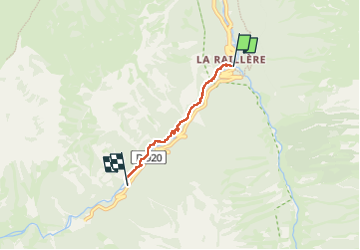
la Ralliére pont d'espagne

ollivier.albert
User

Length
3.1 km

Max alt
1396 m

Uphill gradient
351 m
Km-Effort
6.6 km

Min alt
1043 m

Downhill gradient
5 m
Boucle
No
Creation date :
2025-06-07 12:28:49.698
Updated on :
2025-06-07 14:23:14.86
1h28
Difficulty : Medium

FREE GPS app for hiking
 SityTrail
IGN / Geographical institutes
SityTrail Plus
The world is yours!
About
Trail Walking of 3.1 km to be discovered at Occitania, Hautespyrenees, Cauterets. This trail is proposed by ollivier.albert.
Description
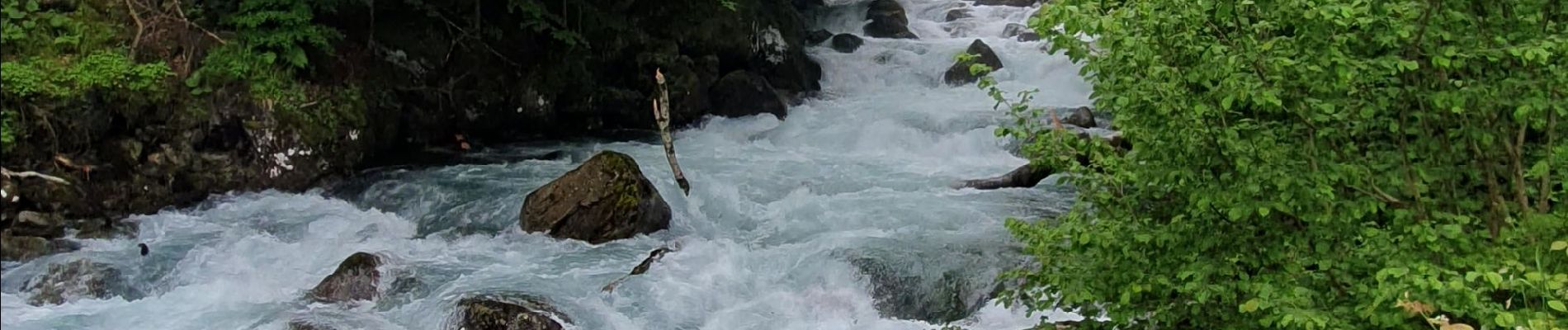
montée pres du torrent
Photos


Positioning
Country:
France
Region :
Occitania
Department/Province :
Hautespyrenees
Municipality :
Cauterets
Location:
Unknown
Start:(Dec)
Start:(UTM)
736141 ; 4750683 (30T) N.
Comments