


bastide 2

Francinedu
User
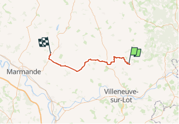

Length
56 km

Max alt
170 m

Uphill gradient
871 m
Km-Effort
67 km

Min alt
55 m

Downhill gradient
886 m
Boucle
No
Creation date :
2025-06-08 07:26:43.456
Updated on :
2025-06-08 21:16:03.441
13h23
Difficulty : Very easy

FREE GPS app for hiking
 SityTrail
IGN / Geographical institutes
SityTrail Plus
The world is yours!
About
Trail Walking of 56 km to be discovered at New Aquitaine, Lot-et-Garonne, Monflanquin. This trail is proposed by Francinedu.
Positioning
Country:
France
Region :
New Aquitaine
Department/Province :
Lot-et-Garonne
Municipality :
Monflanquin
Location:
Unknown
Start:(Dec)
Start:(UTM)
321098 ; 4933643 (31T) N.
Comments