


vallée d'Eure et d'Iton

fredtruc27
User
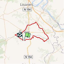

Length
77 km

Max alt
162 m

Uphill gradient
656 m
Km-Effort
86 km

Min alt
30 m

Downhill gradient
648 m
Boucle
No
Creation date :
2015-07-23 00:00:00.0
Updated on :
2015-07-23 00:00:00.0
3h15
Difficulty : Medium

FREE GPS app for hiking
 SityTrail
IGN / Geographical institutes
SityTrail Plus
The world is yours!
About
Trail Cycle of 77 km to be discovered at Normandy, Eure, Le Plessis-Grohan. This trail is proposed by fredtruc27.
Positioning
Country:
France
Region :
Normandy
Department/Province :
Eure
Municipality :
Le Plessis-Grohan
Location:
Unknown
Start:(Dec)
Start:(UTM)
363843 ; 5424196 (31U) N.
Comments