


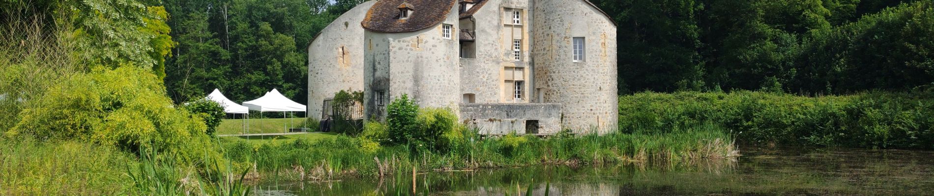
Le chateau de la chasse

avdem
User
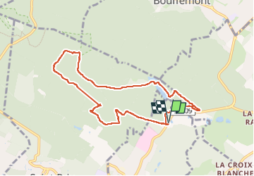

Length
8.3 km

Max alt
178 m

Uphill gradient
157 m
Km-Effort
10.3 km

Min alt
99 m

Downhill gradient
157 m
Boucle
Yes
Creation date :
2025-06-10 07:34:19.277
Updated on :
2025-06-10 10:35:11.604
3h00
Difficulty : Easy

FREE GPS app for hiking
 SityTrail
IGN / Geographical institutes
SityTrail Plus
The world is yours!
About
Trail Walking of 8.3 km to be discovered at Ile-de-France, Val-d'Oise, Montlignon. This trail is proposed by avdem.
Description
Facile
Photos


Positioning
Country:
France
Region :
Ile-de-France
Department/Province :
Val-d'Oise
Municipality :
Montlignon
Location:
Unknown
Start:(Dec)
Start:(UTM)
448530 ; 5430298 (31U) N.
Comments