


col colombiers a la pointe d'Almet

jacquesduchesne
User

Length
11.3 km

Max alt
2184 m

Uphill gradient
893 m
Km-Effort
23 km

Min alt
1588 m

Downhill gradient
890 m
Boucle
Yes
Creation date :
2025-06-11 06:56:01.189
Updated on :
2025-06-11 14:42:31.996
7h45
Difficulty : Very difficult

FREE GPS app for hiking
 SityTrail
IGN / Geographical institutes
SityTrail Plus
The world is yours!
About
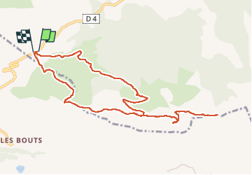
Trail Walking of 11.3 km to be discovered at Auvergne-Rhône-Alpes, Upper Savoy, Le Reposoir. This trail is proposed by jacquesduchesne.
Positioning
Country:
France
Region :
Auvergne-Rhône-Alpes
Department/Province :
Upper Savoy
Municipality :
Le Reposoir
Location:
Unknown
Start:(Dec)
Start:(UTM)
304600 ; 5096302 (32T) N.
Comments