


Sorgues, Île de l'Oiselet, Pont des Armeniers, passerelle himalayenne

ALAPETITE
User
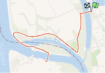

Length
8.3 km

Max alt
35 m

Uphill gradient
64 m
Km-Effort
9.1 km

Min alt
19 m

Downhill gradient
64 m
Boucle
Yes
Creation date :
2025-06-13 06:47:08.37
Updated on :
2025-06-13 14:00:08.74
2h07
Difficulty : Very easy

FREE GPS app for hiking
 SityTrail
IGN / Geographical institutes
SityTrail Plus
The world is yours!
About
Trail Walking of 8.3 km to be discovered at Provence-Alpes-Côte d'Azur, Vaucluse, Sorgues. This trail is proposed by ALAPETITE.
Positioning
Country:
France
Region :
Provence-Alpes-Côte d'Azur
Department/Province :
Vaucluse
Municipality :
Sorgues
Location:
Unknown
Start:(Dec)
Start:(UTM)
647910 ; 4876053 (31T) N.
Comments