


Saint zacharie ,le Pas de Peyruis, les sources de l'huveaune

giovannoni
User
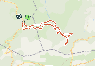

Length
9 km

Max alt
488 m

Uphill gradient
165 m
Km-Effort
11.2 km

Min alt
407 m

Downhill gradient
170 m
Boucle
Yes
Creation date :
2025-06-13 06:27:08.324
Updated on :
2025-06-13 09:18:12.608
2h20
Difficulty : Easy

FREE GPS app for hiking
 SityTrail
IGN / Geographical institutes
SityTrail Plus
The world is yours!
About
Trail Walking of 9 km to be discovered at Provence-Alpes-Côte d'Azur, Var, Saint-Zacharie. This trail is proposed by giovannoni.
Positioning
Country:
France
Region :
Provence-Alpes-Côte d'Azur
Department/Province :
Var
Municipality :
Saint-Zacharie
Location:
Unknown
Start:(Dec)
Start:(UTM)
721715 ; 4804040 (31T) N.
Comments