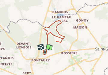
Trail Walking Mettet - Pontaury Bambois - Photo

Pontaury Bambois

© OpenStreetMap contributors
Length
Length
11.5 km
Max alt
Max alt
287 m
Uphill gradient
Uphill gradient
148 m
Km-Effort
Km-Effort  
13.5 km
Min alt
Min alt
230 m
Downhill gradient
Downhill gradient
148 m
Boucle
Boucle
Yes
Creation date :
2025-06-13 07:55:33.751
Updated on :
2025-06-14 11:47:47.529

(0 Reviews)

Walking
Walking
2h37
Difficulty : Medium

Scan this QR Code to open this trail in the SityTrail application

FREE GPS app for hiking

Logo SityTrail SityTrail

IGN / Geographical institutes

Download SityTrail from the App Store Download SityTrail from Google Play

Logo SityTrail SityTrail Plus

The world is yours!

Download SityTrail from the App Store Download SityTrail from Google Play Download SityTrail on Huawei AppGallery

About

Trail Walking of 11.5 km to be discovered at Wallonia, Namur, Mettet. This trail is proposed by Bruno Carlier.

Description

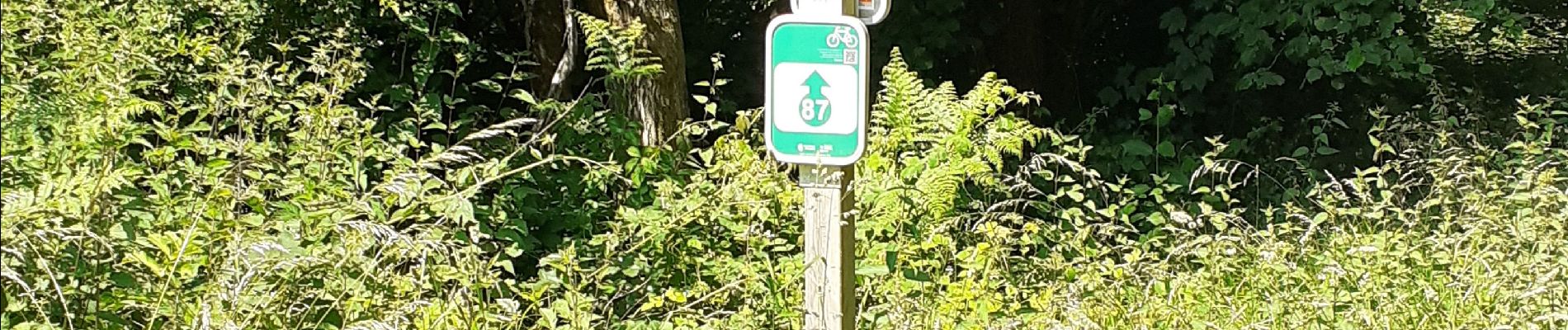
De Pontaury à Bambois à travers la forêt, le long du ruisseau de Belle Eau (photo) qui alimente le lac de Bambois. Attention erreur de ma part lors du retour, propriété privée, chemin barré avec des fils barbelés, tourner à droite au ravel, suivre panneau 87 (voir photo) ne pas continuer tout droit dans la descente

Elevation profile

Photos

Positioning

Country:
Belgium
Region :
Wallonia
Department/Province :
Namur
Municipality :
Mettet
Location:
Unknown
Start:(UTM)
618782 ; 5578071 (31U) N.


Close
My subscriptions