


Etape 10 - GRR2

Ko-Rando
User

Length
21 km

Max alt
2427 m

Uphill gradient
1041 m
Km-Effort
32 km

Min alt
1570 m

Downhill gradient
369 m
Boucle
No
Creation date :
2025-06-14 04:48:22.739
Updated on :
2025-08-05 08:35:08.212
6h53
Difficulty : Medium

FREE GPS app for hiking
 SityTrail
IGN / Geographical institutes
SityTrail Plus
The world is yours!
About
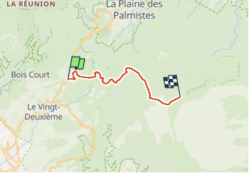
Trail Walking of 21 km to be discovered at Réunion, Unknown, Le Tampon. This trail is proposed by Ko-Rando.
Description
De Bourg Murat au gîte du Volcan.
Après avoir passé deux jours sous la pluie, j'ai eu l'impression d'arriver au paradis.
Une merveille !
Positioning
Country:
France
Region :
Réunion
Department/Province :
Unknown
Municipality :
Le Tampon
Location:
Unknown
Start:(Dec)
Start:(UTM)
352020 ; 7654967 (40K) S.
Comments