


Etape 11/2 - GRR2 - Piton de la fournaise

Ko-Rando
User

Length
13.6 km

Max alt
2490 m

Uphill gradient
573 m
Km-Effort
21 km

Min alt
2212 m

Downhill gradient
573 m
Boucle
Yes
Creation date :
2025-06-15 00:34:58.992
Updated on :
2025-08-05 08:36:04.767
3h36
Difficulty : Medium

FREE GPS app for hiking
 SityTrail
IGN / Geographical institutes
SityTrail Plus
The world is yours!
About
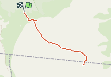
Trail Walking of 13.6 km to be discovered at Réunion, Unknown, Sainte-Rose. This trail is proposed by Ko-Rando.
Description
L'ascension du Piton de la fournaise.
Une expérience incroyable et un des plus beaux levé de soleil de ma vie.
Positioning
Country:
France
Region :
Réunion
Department/Province :
Unknown
Municipality :
Sainte-Rose
Location:
Unknown
Start:(Dec)
Start:(UTM)
363717 ; 7653182 (40K) S.
Comments