


17 juin

arnoultjf
User
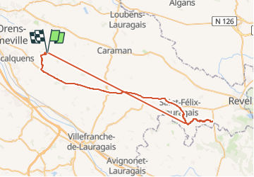

Length
68 km

Max alt
326 m

Uphill gradient
863 m
Km-Effort
79 km

Min alt
170 m

Downhill gradient
863 m
Boucle
Yes
Creation date :
2025-06-17 10:55:15.51
Updated on :
2025-06-17 16:17:40.046
3h59
Difficulty : Very difficult

FREE GPS app for hiking
 SityTrail
IGN / Geographical institutes
SityTrail Plus
The world is yours!
About
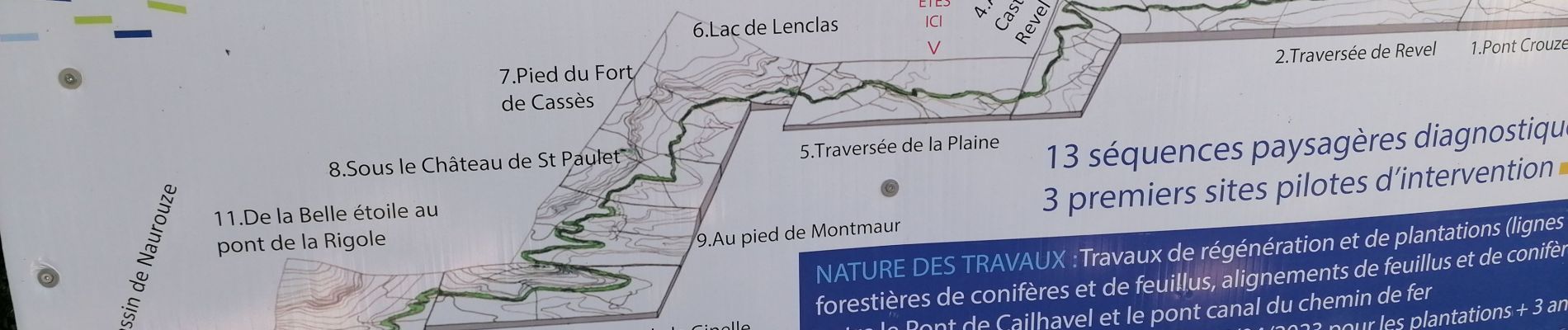
Trail Walking of 68 km to be discovered at Occitania, Haute-Garonne, Préserville. This trail is proposed by arnoultjf.
Photos


Positioning
Country:
France
Region :
Occitania
Department/Province :
Haute-Garonne
Municipality :
Préserville
Location:
Unknown
Start:(Dec)
Start:(UTM)
389280 ; 4820163 (31T) N.
Comments