


Lac de Gaude

ollivier.albert
User
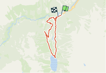

Length
6.7 km

Max alt
1764 m

Uphill gradient
319 m
Km-Effort
10.9 km

Min alt
1465 m

Downhill gradient
313 m
Boucle
Yes
Creation date :
2025-06-17 13:26:37.146
Updated on :
2025-06-17 16:43:51.535
2h22
Difficulty : Medium

FREE GPS app for hiking
 SityTrail
IGN / Geographical institutes
SityTrail Plus
The world is yours!
About
Trail Walking of 6.7 km to be discovered at Occitania, Hautespyrenees, Cauterets. This trail is proposed by ollivier.albert.
Description
du Pont d'Espagne au lac de Gaude AR
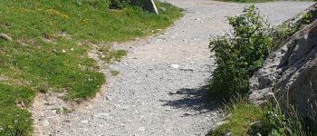
Photos


Positioning
Country:
France
Region :
Occitania
Department/Province :
Hautespyrenees
Municipality :
Cauterets
Location:
Unknown
Start:(Dec)
Start:(UTM)
734053 ; 4748393 (30T) N.
Comments