


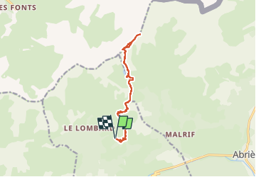
Queyras : A/R Lac Malrif, Col Malrif, Pic du Malrif

manumax
User

Length
13.8 km

Max alt
2931 m

Uphill gradient
1007 m
Km-Effort
27 km

Min alt
1963 m

Downhill gradient
1008 m
Boucle
Yes
Creation date :
2025-06-18 06:24:15.732
Updated on :
2025-06-21 20:23:54.638
6h49
Difficulty : Very difficult

FREE GPS app for hiking
 SityTrail
IGN / Geographical institutes
SityTrail Plus
The world is yours!
About
Trail Walking of 13.8 km to be discovered at Provence-Alpes-Côte d'Azur, Hautes-Alpes, Aiguilles. This trail is proposed by manumax.
Description
A/R Lac Malrif, Col Malrif, Pic du Malrif
Fait le 18/06/2025
Positioning
Country:
France
Region :
Provence-Alpes-Côte d'Azur
Department/Province :
Hautes-Alpes
Municipality :
Aiguilles
Location:
Unknown
Start:(Dec)
Start:(UTM)
331139 ; 4962907 (32T) N.
Comments