


La palud sur verdon

raygautier
User
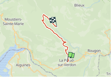

Length
18.3 km

Max alt
1513 m

Uphill gradient
812 m
Km-Effort
28 km

Min alt
909 m

Downhill gradient
580 m
Boucle
No
Creation date :
2025-06-18 07:17:33.0
Updated on :
2025-06-18 16:40:41.702
7h55
Difficulty : Very difficult

FREE GPS app for hiking
 SityTrail
IGN / Geographical institutes
SityTrail Plus
The world is yours!
About
Trail Walking of 18.3 km to be discovered at Provence-Alpes-Côte d'Azur, Alpes-de-Haute-Provence, La Palud-sur-Verdon. This trail is proposed by raygautier.
Positioning
Country:
France
Region :
Provence-Alpes-Côte d'Azur
Department/Province :
Alpes-de-Haute-Provence
Municipality :
La Palud-sur-Verdon
Location:
Unknown
Start:(Dec)
Start:(UTM)
286111 ; 4850906 (32T) N.
Comments