


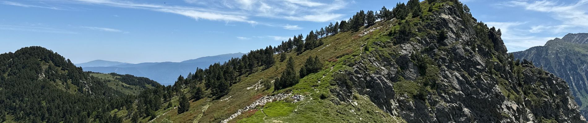
Le Tarbesou

cedric.fargues
User
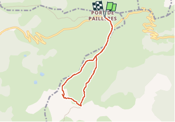

Length
7.2 km

Max alt
2351 m

Uphill gradient
426 m
Km-Effort
12.9 km

Min alt
1927 m

Downhill gradient
425 m
Boucle
Yes
Creation date :
2025-06-19 08:08:20.0
Updated on :
2025-06-19 13:26:01.197
5h16
Difficulty : Difficult

FREE GPS app for hiking
 SityTrail
IGN / Geographical institutes
SityTrail Plus
The world is yours!
About
Trail Walking of 7.2 km to be discovered at Occitania, Ariège, Ascou. This trail is proposed by cedric.fargues.
Photos


Positioning
Country:
France
Region :
Occitania
Department/Province :
Ariège
Municipality :
Ascou
Location:
Unknown
Start:(Dec)
Start:(UTM)
416974 ; 4731758 (31T) N.
Comments