


GR15 Septième étape

c.chehere
User
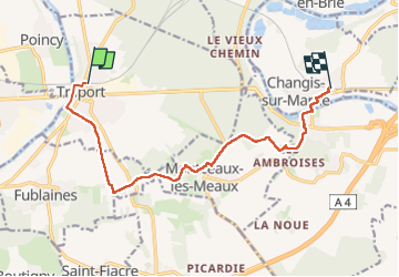

Length
11 km

Max alt
163 m

Uphill gradient
165 m
Km-Effort
13.2 km

Min alt
46 m

Downhill gradient
163 m
Boucle
No
Creation date :
2025-06-20 05:50:25.313
Updated on :
2025-06-20 15:25:50.007
2h59
Difficulty : Difficult

FREE GPS app for hiking
 SityTrail
IGN / Geographical institutes
SityTrail Plus
The world is yours!
About
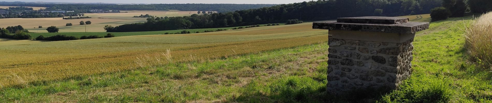
Trail Walking of 11 km to be discovered at Ile-de-France, Seine-et-Marne, Trilport. This trail is proposed by c.chehere.
Description
De Trilport à Changis St Martin
Photos


Positioning
Country:
France
Region :
Ile-de-France
Department/Province :
Seine-et-Marne
Municipality :
Trilport
Location:
Unknown
Start:(Dec)
Start:(UTM)
496302 ; 5423011 (31U) N.
Comments