


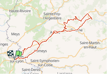
Chazelles / Col des brosses

ramsay
User

Length
44 km

Max alt
899 m

Uphill gradient
1230 m
Km-Effort
60 km

Min alt
547 m

Downhill gradient
1230 m
Boucle
Yes
Creation date :
2015-07-26 00:00:00.0
Updated on :
2015-07-26 00:00:00.0
3h47
Difficulty : Difficult

FREE GPS app for hiking
 SityTrail
IGN / Geographical institutes
SityTrail Plus
The world is yours!
About
Trail Mountain bike of 44 km to be discovered at Auvergne-Rhône-Alpes, Loire, Chazelles-sur-Lyon. This trail is proposed by ramsay.
Description
Rando organisée par Nanard
Positioning
Country:
France
Region :
Auvergne-Rhône-Alpes
Department/Province :
Loire
Municipality :
Chazelles-sur-Lyon
Location:
Unknown
Start:(Dec)
Start:(UTM)
607928 ; 5054515 (31T) N.
Comments