


Bruyères Montagne des fourmis et chêne de la vierge reconnu

noelphil
User
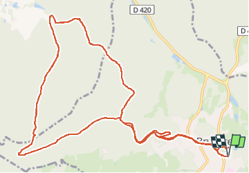

Length
14 km

Max alt
569 m

Uphill gradient
350 m
Km-Effort
18.7 km

Min alt
389 m

Downhill gradient
349 m
Boucle
Yes
Creation date :
2025-06-20 12:15:07.644
Updated on :
2025-06-20 21:40:05.993
4h15
Difficulty : Difficult

FREE GPS app for hiking
 SityTrail
IGN / Geographical institutes
SityTrail Plus
The world is yours!
About
Trail Walking of 14 km to be discovered at Grand Est, Vosges, Bruyères. This trail is proposed by noelphil.
Positioning
Country:
France
Region :
Grand Est
Department/Province :
Vosges
Municipality :
Bruyères
Location:
Unknown
Start:(Dec)
Start:(UTM)
330861 ; 5342038 (32U) N.
Comments