


Chiran

raygautier
User
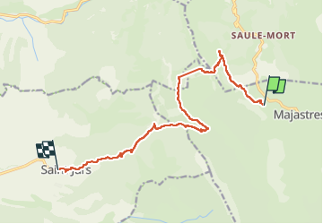

Length
14.7 km

Max alt
1329 m

Uphill gradient
594 m
Km-Effort
23 km

Min alt
864 m

Downhill gradient
801 m
Boucle
No
Creation date :
2025-06-20 08:42:53.0
Updated on :
2025-06-20 18:01:25.929
7h04
Difficulty : Very difficult

FREE GPS app for hiking
 SityTrail
IGN / Geographical institutes
SityTrail Plus
The world is yours!
About
Trail Walking of 14.7 km to be discovered at Provence-Alpes-Côte d'Azur, Alpes-de-Haute-Provence, Majastres. This trail is proposed by raygautier.
Positioning
Country:
France
Region :
Provence-Alpes-Côte d'Azur
Department/Province :
Alpes-de-Haute-Provence
Municipality :
Majastres
Location:
Unknown
Start:(Dec)
Start:(UTM)
281255 ; 4866174 (32T) N.
Comments