


Port Saint Pierre 20250621

plongeurnormand
User
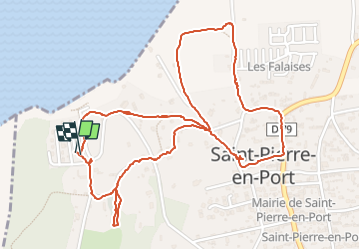

Length
3 km

Max alt
89 m

Uphill gradient
80 m
Km-Effort
4.1 km

Min alt
13 m

Downhill gradient
81 m
Boucle
Yes
Creation date :
2025-06-21 07:45:55.7
Updated on :
2025-06-21 10:03:23.091
2h17
Difficulty : Easy

FREE GPS app for hiking
 SityTrail
IGN / Geographical institutes
SityTrail Plus
The world is yours!
About
Trail Walking of 3 km to be discovered at Normandy, Seine-Maritime, Saint-Pierre-en-Port. This trail is proposed by plongeurnormand.
Description
marche
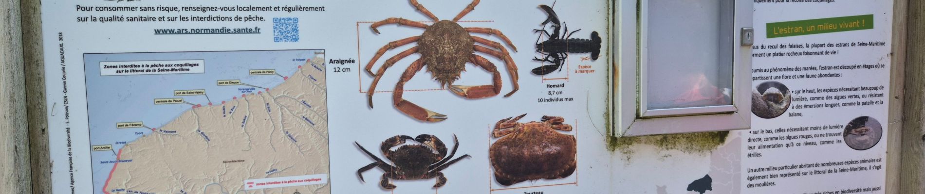
Photos


Positioning
Country:
France
Region :
Normandy
Department/Province :
Seine-Maritime
Municipality :
Saint-Pierre-en-Port
Location:
Unknown
Start:(Dec)
Start:(UTM)
319163 ; 5520235 (31U) N.
Comments