


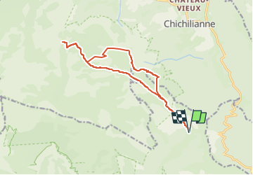
val combeau vers tête chevalière puis cabane chaumayoux et retour par le plateau

planets
User

Length
15.8 km

Max alt
1946 m

Uphill gradient
761 m
Km-Effort
26 km

Min alt
1445 m

Downhill gradient
759 m
Boucle
Yes
Creation date :
2025-06-22 16:01:04.396
Updated on :
2025-06-22 16:01:09.746
5h53
Difficulty : Medium

FREE GPS app for hiking
 SityTrail
IGN / Geographical institutes
SityTrail Plus
The world is yours!
About
Trail Walking of 15.8 km to be discovered at Auvergne-Rhône-Alpes, Drôme, Châtillon-en-Diois. This trail is proposed by planets.
Positioning
Country:
France
Region :
Auvergne-Rhône-Alpes
Department/Province :
Drôme
Municipality :
Châtillon-en-Diois
Location:
Treschenu-Creyers
Start:(Dec)
Start:(UTM)
703635 ; 4960998 (31T) N.
Comments