


Vanoise J 1 ( parking/refuge

DUCLUZEAU
User

Length
7.6 km

Max alt
2517 m

Uphill gradient
1097 m
Km-Effort
18.6 km

Min alt
1418 m

Downhill gradient
5 m
Boucle
No
Creation date :
2025-06-23 19:15:57.641
Updated on :
2025-06-23 19:15:59.573
4h13
Difficulty : Difficult

FREE GPS app for hiking
 SityTrail
IGN / Geographical institutes
SityTrail Plus
The world is yours!
About
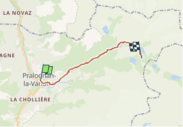
Trail Walking of 7.6 km to be discovered at Auvergne-Rhône-Alpes, Savoy, Pralognan-la-Vanoise. This trail is proposed by DUCLUZEAU.
Positioning
Country:
France
Region :
Auvergne-Rhône-Alpes
Department/Province :
Savoy
Municipality :
Pralognan-la-Vanoise
Location:
Unknown
Start:(Dec)
Start:(UTM)
321677 ; 5027836 (32T) N.
Comments