


fanon mardi

Michel Leriche 08
User
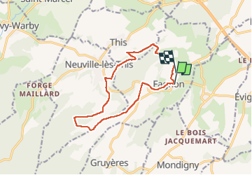

Length
12.9 km

Max alt
306 m

Uphill gradient
347 m
Km-Effort
17.5 km

Min alt
172 m

Downhill gradient
343 m
Boucle
No
Creation date :
2025-06-24 11:44:29.89
Updated on :
2025-06-24 15:41:29.816
3h56
Difficulty : Difficult

FREE GPS app for hiking
 SityTrail
IGN / Geographical institutes
SityTrail Plus
The world is yours!
About
Trail Walking of 12.9 km to be discovered at Grand Est, Ardennes, Fagnon. This trail is proposed by Michel Leriche 08.
Description
temps chaud
Positioning
Country:
France
Region :
Grand Est
Department/Province :
Ardennes
Municipality :
Fagnon
Location:
Unknown
Start:(Dec)
Start:(UTM)
617904 ; 5510526 (31U) N.
Comments