


tour en calèche

Tommy Eric
User

Length
8.6 km

Max alt
244 m

Uphill gradient
54 m
Km-Effort
9.3 km

Min alt
229 m

Downhill gradient
57 m
Boucle
No
Creation date :
2025-06-25 18:42:48.731
Updated on :
2025-06-25 20:02:50.485
1h17
Difficulty : Very easy

FREE GPS app for hiking
 SityTrail
IGN / Geographical institutes
SityTrail Plus
The world is yours!
About
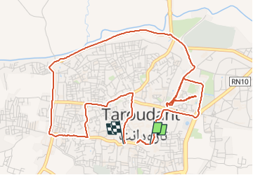
Trail Coupling of 8.6 km to be discovered at Souss-Massa, Pachalik de Taroudant, Taroudant. This trail is proposed by Tommy Eric.
Description
tour en calèche
Positioning
Country:
Morocco
Region :
Souss-Massa
Department/Province :
Pachalik de Taroudant
Municipality :
Taroudant
Location:
Unknown
Start:(Dec)
Start:(UTM)
511829 ; 3370712 (29R) N.
Comments