


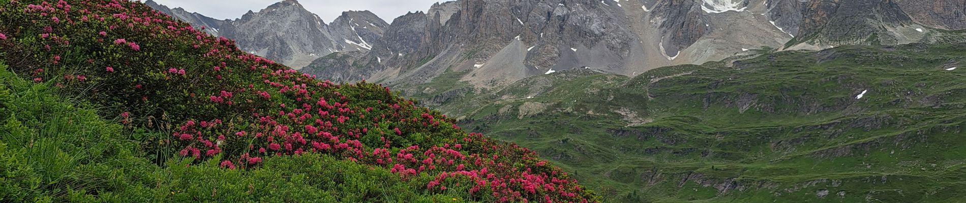
Lacs long, rond et muandes

JLKino
User
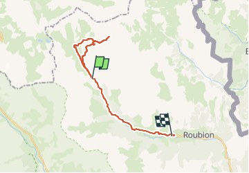

Length
23 km

Max alt
2590 m

Uphill gradient
650 m
Km-Effort
33 km

Min alt
1596 m

Downhill gradient
1070 m
Boucle
No
Creation date :
2025-06-27 05:01:06.755
Updated on :
2025-06-27 18:41:29.285
8h52
Difficulty : Very difficult

FREE GPS app for hiking
 SityTrail
IGN / Geographical institutes
SityTrail Plus
The world is yours!
About
Trail Walking of 23 km to be discovered at Provence-Alpes-Côte d'Azur, Hautes-Alpes, Névache. This trail is proposed by JLKino.
Photos


Positioning
Country:
France
Region :
Provence-Alpes-Côte d'Azur
Department/Province :
Hautes-Alpes
Municipality :
Névache
Location:
Unknown
Start:(Dec)
Start:(UTM)
305204 ; 4992501 (32T) N.
Comments