


Lac de Belledone

AnaisLambert
User

Length
28 km

Max alt
2402 m

Uphill gradient
1595 m
Km-Effort
49 km

Min alt
1126 m

Downhill gradient
1592 m
Boucle
Yes
Creation date :
2025-06-28 07:10:20.82
Updated on :
2025-07-20 18:42:08.697
29h43
Difficulty : Medium

FREE GPS app for hiking
 SityTrail
IGN / Geographical institutes
SityTrail Plus
The world is yours!
About
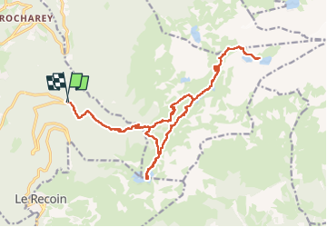
Trail Walking of 28 km to be discovered at Auvergne-Rhône-Alpes, Isère, Saint-Martin-d'Uriage. This trail is proposed by AnaisLambert.
Positioning
Country:
France
Region :
Auvergne-Rhône-Alpes
Department/Province :
Isère
Municipality :
Saint-Martin-d'Uriage
Location:
Unknown
Start:(Dec)
Start:(UTM)
726939 ; 5003879 (31T) N.
Comments