


Fiz J 3

DUCLUZEAU
User
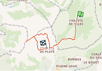

Length
12.9 km

Max alt
2658 m

Uphill gradient
1066 m
Km-Effort
27 km

Min alt
1870 m

Downhill gradient
895 m
Boucle
No
Creation date :
2025-07-03 11:47:31.971
Updated on :
2025-07-03 11:47:34.933
6h01
Difficulty : Very difficult

FREE GPS app for hiking
 SityTrail
IGN / Geographical institutes
SityTrail Plus
The world is yours!
About
Trail Walking of 12.9 km to be discovered at Auvergne-Rhône-Alpes, Upper Savoy, Sixt-Fer-à-Cheval. This trail is proposed by DUCLUZEAU.
Positioning
Country:
France
Region :
Auvergne-Rhône-Alpes
Department/Province :
Upper Savoy
Municipality :
Sixt-Fer-à-Cheval
Location:
Unknown
Start:(Dec)
Start:(UTM)
325967 ; 5095349 (32T) N.
Comments