


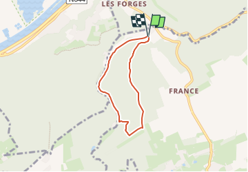
boucle bois d'Ombret et ruisseau du fond d'Oxhe

psyberty
User

Length
4.7 km

Max alt
233 m

Uphill gradient
139 m
Km-Effort
6.6 km

Min alt
114 m

Downhill gradient
141 m
Boucle
Yes
Creation date :
2025-07-03 14:19:11.705
Updated on :
2025-07-03 15:13:37.023
1h29
Difficulty : Medium

FREE GPS app for hiking
 SityTrail
IGN / Geographical institutes
SityTrail Plus
The world is yours!
About
Trail Walking of 4.7 km to be discovered at Wallonia, Liège, Nandrin. This trail is proposed by psyberty.
Description
promenade agréable en forêt et le long du ruisseau. Cependant, une montée et descente difficile fort rocailleuse et humide par temps de pluie. Belle vue jusqu'à l'autre rive de la Meuse sur les éoliennes de Verlaine.
Photos


Positioning
Country:
Belgium
Region :
Wallonia
Department/Province :
Liège
Municipality :
Nandrin
Location:
Unknown
Start:(Dec)
Start:(UTM)
666461 ; 5600780 (31U) N.
Comments