


boucle pepoiri petoumier

aris
User
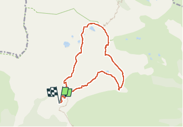

Length
8.2 km

Max alt
2658 m

Uphill gradient
681 m
Km-Effort
17.3 km

Min alt
2031 m

Downhill gradient
679 m
Boucle
Yes
Creation date :
2025-07-07 06:46:54.875
Updated on :
2025-07-07 11:13:15.128
4h25
Difficulty : Medium

FREE GPS app for hiking
 SityTrail
IGN / Geographical institutes
SityTrail Plus
The world is yours!
About
Trail Walking of 8.2 km to be discovered at Provence-Alpes-Côte d'Azur, Maritime Alps, Valdeblore. This trail is proposed by aris.
Positioning
Country:
France
Region :
Provence-Alpes-Côte d'Azur
Department/Province :
Maritime Alps
Municipality :
Valdeblore
Location:
Unknown
Start:(Dec)
Start:(UTM)
354867 ; 4884431 (32T) N.
Comments