


tan

Laurent53
User

Length
9.7 km

Max alt
39 m

Uphill gradient
105 m
Km-Effort
11.1 km

Min alt
-2 m

Downhill gradient
104 m
Boucle
Yes
Creation date :
2025-07-08 07:36:13.398
Updated on :
2025-07-08 10:35:10.862
2h58
Difficulty : Medium

FREE GPS app for hiking
 SityTrail
IGN / Geographical institutes
SityTrail Plus
The world is yours!
About
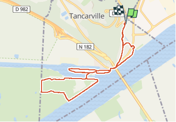
Trail Walking of 9.7 km to be discovered at Normandy, Seine-Maritime, Tancarville. This trail is proposed by Laurent53.
Positioning
Country:
France
Region :
Normandy
Department/Province :
Seine-Maritime
Municipality :
Tancarville
Location:
Unknown
Start:(Dec)
Start:(UTM)
316473 ; 5484457 (31U) N.
Comments