


Les passerelles

lorenzot54
User
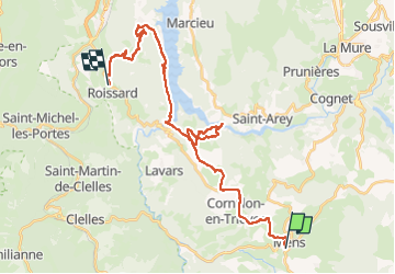

Length
32 km

Max alt
955 m

Uphill gradient
1081 m
Km-Effort
46 km

Min alt
470 m

Downhill gradient
1077 m
Boucle
No
Creation date :
2025-07-08 06:32:15.0
Updated on :
2025-07-08 11:18:04.882
3h30
Difficulty : Very difficult

FREE GPS app for hiking
 SityTrail
IGN / Geographical institutes
SityTrail Plus
The world is yours!
About
Trail Mountain bike of 32 km to be discovered at Auvergne-Rhône-Alpes, Isère, Mens. This trail is proposed by lorenzot54.
Positioning
Country:
France
Region :
Auvergne-Rhône-Alpes
Department/Province :
Isère
Municipality :
Mens
Location:
Unknown
Start:(Dec)
Start:(UTM)
717327 ; 4966039 (31T) N.
Comments