


og-R19

Jack-94
User
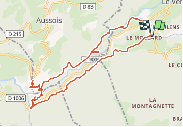

Length
13.3 km

Max alt
1356 m

Uphill gradient
518 m
Km-Effort
20 km

Min alt
1181 m

Downhill gradient
519 m
Boucle
Yes
Creation date :
2025-07-08 11:45:48.118
Updated on :
2025-07-08 17:44:15.179
5h58
Difficulty : Very difficult

FREE GPS app for hiking
 SityTrail
IGN / Geographical institutes
SityTrail Plus
The world is yours!
About
Trail Walking of 13.3 km to be discovered at Auvergne-Rhône-Alpes, Savoy, Val-Cenis. This trail is proposed by Jack-94.
Positioning
Country:
France
Region :
Auvergne-Rhône-Alpes
Department/Province :
Savoy
Municipality :
Val-Cenis
Location:
Unknown
Start:(Dec)
Start:(UTM)
325427 ; 5010192 (32T) N.
Comments