


circuit des lacs depuis le col de la Cayolle

PhilB24
User
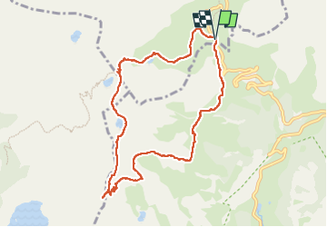

Length
9.5 km

Max alt
2675 m

Uphill gradient
471 m
Km-Effort
15.7 km

Min alt
2243 m

Downhill gradient
471 m
Boucle
Yes
Creation date :
2025-07-08 08:44:31.285
Updated on :
2025-07-08 19:25:11.109
3h34
Difficulty : Difficult

FREE GPS app for hiking
 SityTrail
IGN / Geographical institutes
SityTrail Plus
The world is yours!
About
Trail Walking of 9.5 km to be discovered at Provence-Alpes-Côte d'Azur, Alpes-de-Haute-Provence, Uvernet-Fours. This trail is proposed by PhilB24.
Description
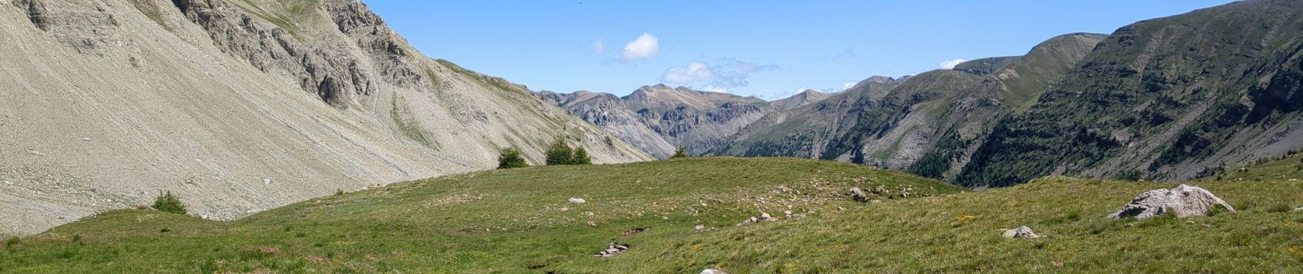
Parking au col. Rando sans difficulté technique, très joli décor minéral. Sentier très bien balisé.
Photos


Positioning
Country:
France
Region :
Provence-Alpes-Côte d'Azur
Department/Province :
Alpes-de-Haute-Provence
Municipality :
Uvernet-Fours
Location:
Unknown
Start:(Dec)
Start:(UTM)
319902 ; 4903208 (32T) N.
Comments