


Mechelse Heide

mavbelgium
User

Length
18.7 km

Max alt
97 m

Uphill gradient
227 m
Km-Effort
22 km

Min alt
57 m

Downhill gradient
200 m
Boucle
No
Creation date :
2015-07-31 00:00:00.0
Updated on :
2015-07-31 00:00:00.0
2h40
Difficulty : Easy

FREE GPS app for hiking
 SityTrail
IGN / Geographical institutes
SityTrail Plus
The world is yours!
About
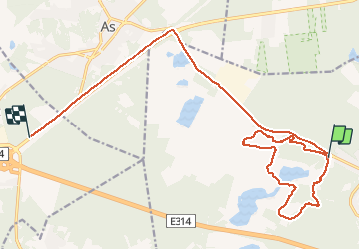
Trail Walking of 18.7 km to be discovered at Flanders, Limburg, Maasmechelen. This trail is proposed by mavbelgium.
Description
mooie tocht van 10 km door Mechelse Heide.. matig pittig door de steile (korte) hellingen/trappen. Mooi zicht van de streek op hoogste punt vd wandeling
Photos


Positioning
Country:
Belgium
Region :
Flanders
Department/Province :
Limburg
Municipality :
Maasmechelen
Location:
Mechelen-aan-de-Maas
Start:(Dec)
Start:(UTM)
686650 ; 5650730 (31U) N.
Comments