


T-JG-R2-1

Jack-94
User
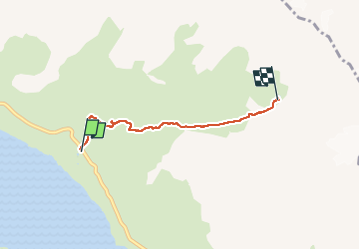

Length
3.9 km

Max alt
2764 m

Uphill gradient
665 m
Km-Effort
10.5 km

Min alt
2096 m

Downhill gradient
0 m
Boucle
No
Creation date :
2025-07-10 07:36:14.409
Updated on :
2025-07-11 13:54:44.79
2h46
Difficulty : Medium

FREE GPS app for hiking
 SityTrail
IGN / Geographical institutes
SityTrail Plus
The world is yours!
About
Trail Walking of 3.9 km to be discovered at Auvergne-Rhône-Alpes, Savoy, Val-Cenis. This trail is proposed by Jack-94.
Positioning
Country:
France
Region :
Auvergne-Rhône-Alpes
Department/Province :
Savoy
Municipality :
Val-Cenis
Location:
Lanslebourg-Mont-Cenis
Start:(Dec)
Start:(UTM)
339180 ; 5011739 (32T) N.
Comments