


lac verdet + pas de Touréis 2674 m

PhilB24
User
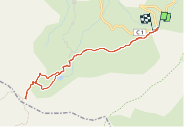

Length
5.3 km

Max alt
2673 m

Uphill gradient
275 m
Km-Effort
9 km

Min alt
2398 m

Downhill gradient
285 m
Boucle
Yes
Creation date :
2025-07-14 10:00:36.747
Updated on :
2025-07-15 17:55:48.191
1h34
Difficulty : Medium

FREE GPS app for hiking
 SityTrail
IGN / Geographical institutes
SityTrail Plus
The world is yours!
About
Trail Walking of 5.3 km to be discovered at Provence-Alpes-Côte d'Azur, Alpes-de-Haute-Provence, Jausiers. This trail is proposed by PhilB24.
Description
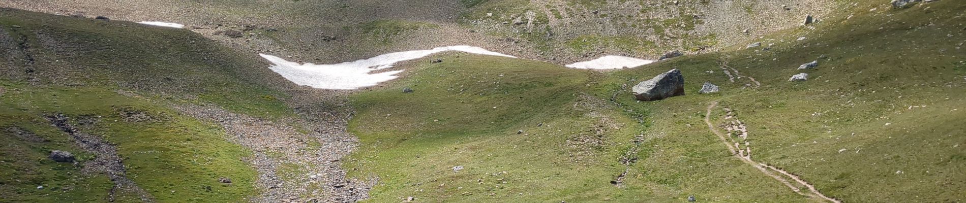
Belle Rando sans difficulté technique.
Photos


Positioning
Country:
France
Region :
Provence-Alpes-Côte d'Azur
Department/Province :
Alpes-de-Haute-Provence
Municipality :
Jausiers
Location:
Unknown
Start:(Dec)
Start:(UTM)
323997 ; 4911804 (32T) N.
Comments