


Lac d'Ilhéou en aller & retour

chrisgps
User
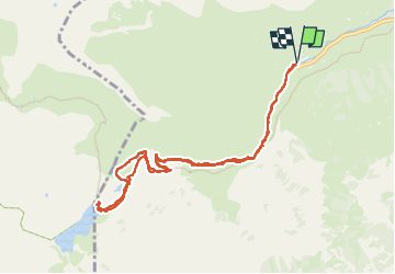

Length
10.2 km

Max alt
1985 m

Uphill gradient
643 m
Km-Effort
18.8 km

Min alt
1347 m

Downhill gradient
642 m
Boucle
Yes
Creation date :
2025-07-13 07:22:38.236
Updated on :
2025-07-16 20:10:07.378
4h16
Difficulty : Difficult

FREE GPS app for hiking
 SityTrail
IGN / Geographical institutes
SityTrail Plus
The world is yours!
About
Trail Walking of 10.2 km to be discovered at Occitania, Hautespyrenees, Cauterets. This trail is proposed by chrisgps.
Positioning
Country:
France
Region :
Occitania
Department/Province :
Hautespyrenees
Municipality :
Cauterets
Location:
Unknown
Start:(Dec)
Start:(UTM)
733349 ; 4751734 (30T) N.
Comments