


J 2: Descente, Sommet/voiture

DUCLUZEAU
User

Length
6 km

Max alt
2710 m

Uphill gradient
0 m
Km-Effort
10.8 km

Min alt
1259 m

Downhill gradient
1442 m
Boucle
No
Creation date :
2025-07-16 20:12:59.722
Updated on :
2025-07-16 20:13:02.004
2h27
Difficulty : Medium

FREE GPS app for hiking
 SityTrail
IGN / Geographical institutes
SityTrail Plus
The world is yours!
About
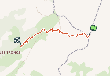
Trail Walking of 6 km to be discovered at Auvergne-Rhône-Alpes, Upper Savoy, Le Reposoir. This trail is proposed by DUCLUZEAU.
Positioning
Country:
France
Region :
Auvergne-Rhône-Alpes
Department/Province :
Upper Savoy
Municipality :
Le Reposoir
Location:
Unknown
Start:(Dec)
Start:(UTM)
310607 ; 5092052 (32T) N.
Comments