


Fiz

DUCLUZEAU
User

Length
22 km

Max alt
2649 m

Uphill gradient
1819 m
Km-Effort
46 km

Min alt
1234 m

Downhill gradient
1820 m
Boucle
Yes
Creation date :
2025-07-16 20:19:16.349
Updated on :
2025-07-16 20:19:18.617
10h25
Difficulty : Very difficult

FREE GPS app for hiking
 SityTrail
IGN / Geographical institutes
SityTrail Plus
The world is yours!
About
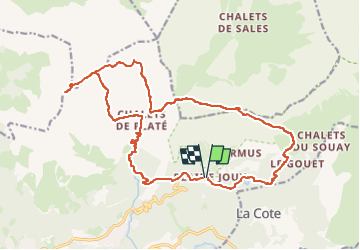
Trail Walking of 22 km to be discovered at Auvergne-Rhône-Alpes, Upper Savoy, Passy. This trail is proposed by DUCLUZEAU.
Positioning
Country:
France
Region :
Auvergne-Rhône-Alpes
Department/Province :
Upper Savoy
Municipality :
Passy
Location:
Unknown
Start:(Dec)
Start:(UTM)
324806 ; 5091105 (32T) N.
Comments