


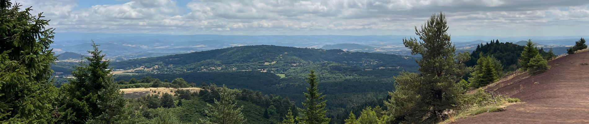
Puys de Lassolas et de la Vache

griffet
User
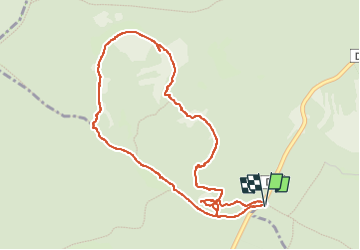

Length
5.1 km

Max alt
1174 m

Uphill gradient
253 m
Km-Effort
8.5 km

Min alt
984 m

Downhill gradient
253 m
Boucle
Yes
Creation date :
2025-07-17 09:33:08.0
Updated on :
2025-07-17 13:53:35.721

FREE GPS app for hiking
 SityTrail
IGN / Geographical institutes
SityTrail Plus
The world is yours!
About
Trail of 5.1 km to be discovered at Auvergne-Rhône-Alpes, Puy-de-Dôme, Saint-Genès-Champanelle. This trail is proposed by griffet.
Description
Les sommets des Puys de Lassolas et de la Vache et découverte de l’ancienne carrière
Photos


Positioning
Country:
France
Region :
Auvergne-Rhône-Alpes
Department/Province :
Puy-de-Dôme
Municipality :
Saint-Genès-Champanelle
Location:
Unknown
Start:(Dec)
Start:(UTM)
497466 ; 5060868 (31T) N.
Comments