


Autrans

panetJeanLuc
User
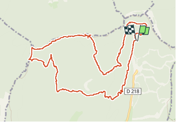

Length
14.7 km

Max alt
1563 m

Uphill gradient
535 m
Km-Effort
22 km

Min alt
1337 m

Downhill gradient
539 m
Boucle
Yes
Creation date :
2025-07-17 07:27:49.362
Updated on :
2025-07-17 14:41:17.043
4h07
Difficulty : Very difficult

FREE GPS app for hiking
 SityTrail
IGN / Geographical institutes
SityTrail Plus
The world is yours!
About
Trail Walking of 14.7 km to be discovered at Auvergne-Rhône-Alpes, Isère, Autrans-Méaudre en Vercors. This trail is proposed by panetJeanLuc.
Positioning
Country:
France
Region :
Auvergne-Rhône-Alpes
Department/Province :
Isère
Municipality :
Autrans-Méaudre en Vercors
Location:
Autrans
Start:(Dec)
Start:(UTM)
702647 ; 5012534 (31T) N.
Comments