


Col giorgiu

fb30
User
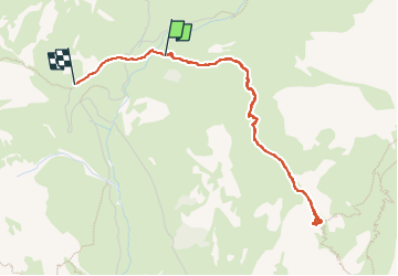

Length
4.8 km

Max alt
2289 m

Uphill gradient
283 m
Km-Effort
8.6 km

Min alt
1977 m

Downhill gradient
310 m
Boucle
No
Creation date :
2025-07-18 08:45:29.0
Updated on :
2025-07-18 12:26:42.791

FREE GPS app for hiking
 SityTrail
IGN / Geographical institutes
SityTrail Plus
The world is yours!
About
Trail of 4.8 km to be discovered at Piemont, Cuneo, Acceglio. This trail is proposed by fb30.
Positioning
Country:
Italy
Region :
Piemont
Department/Province :
Cuneo
Municipality :
Acceglio
Location:
Unknown
Start:(Dec)
Start:(UTM)
333989 ; 4932057 (32T) N.
Comments