


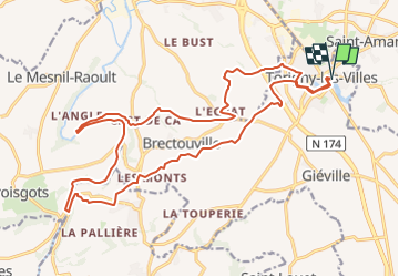
Torigni sur vire

lensois
User

Length
22 km

Max alt
134 m

Uphill gradient
369 m
Km-Effort
27 km

Min alt
25 m

Downhill gradient
368 m
Boucle
Yes
Creation date :
2025-07-22 16:58:53.186
Updated on :
2025-07-22 17:17:20.357
6h05
Difficulty : Very difficult

FREE GPS app for hiking
 SityTrail
IGN / Geographical institutes
SityTrail Plus
The world is yours!
About
Trail Walking of 22 km to be discovered at Normandy, Manche, Torigny-les-Villes. This trail is proposed by lensois.
Positioning
Country:
France
Region :
Normandy
Department/Province :
Manche
Municipality :
Torigny-les-Villes
Location:
Torigni-sur-Vire
Start:(Dec)
Start:(UTM)
647936 ; 5433232 (30U) N.
Comments