


Grotte de Ratapignatta

Thierryrando06
User
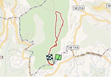

Length
3.3 km

Max alt
497 m

Uphill gradient
158 m
Km-Effort
5.4 km

Min alt
347 m

Downhill gradient
159 m
Boucle
Yes
Creation date :
2025-07-26 07:08:27.866
Updated on :
2025-07-26 09:20:21.384
2h11
Difficulty : Easy

FREE GPS app for hiking
 SityTrail
IGN / Geographical institutes
SityTrail Plus
The world is yours!
About
Trail Walking of 3.3 km to be discovered at Provence-Alpes-Côte d'Azur, Maritime Alps, Falicon. This trail is proposed by Thierryrando06.
Positioning
Country:
France
Region :
Provence-Alpes-Côte d'Azur
Department/Province :
Maritime Alps
Municipality :
Falicon
Location:
Unknown
Start:(Dec)
Start:(UTM)
359731 ; 4844704 (32T) N.
Comments