


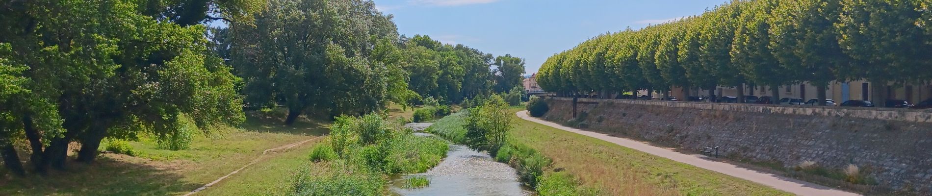
montelimar autour du roubion

stef789
User GUIDE
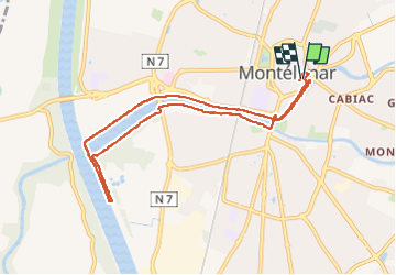

Length
9 km

Max alt
94 m

Uphill gradient
61 m
Km-Effort
9.8 km

Min alt
71 m

Downhill gradient
60 m
Boucle
Yes
Creation date :
2025-07-26 11:17:58.604
Updated on :
2025-07-26 14:14:32.616
2h55
Difficulty : Easy

FREE GPS app for hiking
 SityTrail
IGN / Geographical institutes
SityTrail Plus
The world is yours!
About
Trail Walking of 9 km to be discovered at Auvergne-Rhône-Alpes, Drôme, Montélimar. This trail is proposed by stef789.
Photos


Positioning
Country:
France
Region :
Auvergne-Rhône-Alpes
Department/Province :
Drôme
Municipality :
Montélimar
Location:
Unknown
Start:(Dec)
Start:(UTM)
639201 ; 4935259 (31T) N.
Comments