


Hike 318 jour 1

albert318
User

Length
14.2 km

Max alt
1056 m

Uphill gradient
537 m
Km-Effort
21 km

Min alt
586 m

Downhill gradient
462 m
Boucle
No
Creation date :
2015-08-03 00:00:00.0
Updated on :
2015-08-03 00:00:00.0
6h45
Difficulty : Medium

FREE GPS app for hiking
 SityTrail
IGN / Geographical institutes
SityTrail Plus
The world is yours!
About
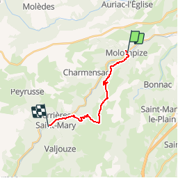
Trail Walking of 14.2 km to be discovered at Auvergne-Rhône-Alpes, Cantal, Molompize. This trail is proposed by albert318.
Description
Molompize - Ferrière saint mary
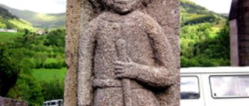
Photos


Positioning
Country:
France
Region :
Auvergne-Rhône-Alpes
Department/Province :
Cantal
Municipality :
Molompize
Location:
Unknown
Start:(Dec)
Start:(UTM)
509981 ; 5008495 (31T) N.
Comments