


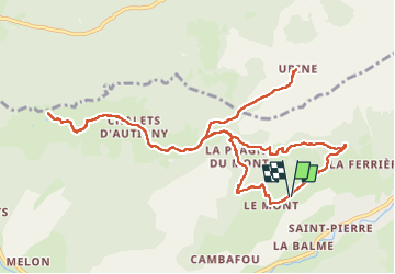
Autigny Ubine

algecko
User

Length
13.5 km

Max alt
1805 m

Uphill gradient
773 m
Km-Effort
24 km

Min alt
1163 m

Downhill gradient
774 m
Boucle
Yes
Creation date :
2025-07-27 06:33:47.0
Updated on :
2025-07-27 12:32:39.552
3h50
Difficulty : Medium

FREE GPS app for hiking
 SityTrail
IGN / Geographical institutes
SityTrail Plus
The world is yours!
About
Trail Walking of 13.5 km to be discovered at Auvergne-Rhône-Alpes, Upper Savoy, Abondance. This trail is proposed by algecko.
Positioning
Country:
France
Region :
Auvergne-Rhône-Alpes
Department/Province :
Upper Savoy
Municipality :
Abondance
Location:
Unknown
Start:(Dec)
Start:(UTM)
326013 ; 5129077 (32T) N.
Comments